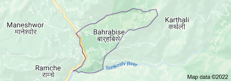
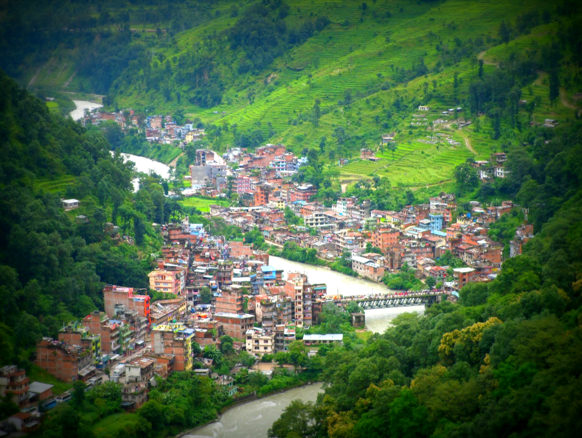
Bahrabise municipality is one of the three municipalities of Sindhupalchowk district. According to the new structure published in the gazette by the Government of Nepal on the 27th of Falgun 2073, this municipality was formed by the former Ghorthali (1-4), Karthali, Bahrbise, Gati, Ghumthang, Maneswara, and Ramche Village Development Committees. Now there are 9 wards within this municipality. Spreading from 500 meters to 4000 meters above sea level, this city has many "thali", "thumka", hills and peaks, so it has become a municipality according to the standards of a Himalayan municipality.
The eastern border of Bahrabise municipality is connected with Dolakha district and the western border is connected with Balephi and Jugal Rural Municipalities. Similarly, the northern and southern borders of Bahrabise are connected with Bhotekoshi Rural Municipality and Tripura Sundari Rural Municipality respectively. You can reach here from Kathmandu through Araniko Highway.
The total area of this municipality is 134.8 square kilometers.
Population of Bahrabise Municipality
According to the 2068 census, the population here was 26535. Similarly, according to the 2078 census, the population of Bahrabise is 24109, of which 12020 (49.9%) are males and 12089 (50.1%) are females. In the same census, the number of houses is 6655 and the number of families is 6994. The population density of Bahrabise is 249 per square km.
There is the majority of the Newari community is in Bahrbise city. There are a lot of Tamang communities in the entire Bahrabise municipality. There are Tamang, Newari, Brahmin, Chhetri, Sherpa, Gurung, and other castes living here. The Thami community belongs to the endangered tribes here.
Wards
- Ward no. 1 - Ghorthali
- Ward no. 2 - Karthali
- Ward no. 3 - Bahrabise
- Ward no. 4 - Bahrabise
- Ward no. 5 - Gathi
- Ward no. 6 - Gathi
- Ward no. 7 - Ghumthang
- Ward no. 8 - Maneshwara
- Ward no. 9 - Rachche
Health Institutions
There are community health institutions in almost all the wards of Bahrbise municipality. Ramche Primary Health Post, Maneshwara Health Post, Karthali Health Post, Ghumthang Health Post, Gati Health Post, Bahrbise Health Post, and others are the health institutions of Bahrabise.
Apart from this, various types of health institutions run by the private sector are operating in different places in Bahrabise.
Educational Institutions: School, college & campus
There are 31 child development centers, 39 primary schools, 6 basic schools, 9 secondary schools, and 1 campus throughout Bahrabise municipality. These educational institutions are all community-oriented. Apart from this, there are also private educational institutions.
According to 2068, the total literacy rate was 62.76 percent of which 55.05 percent were female and 70.97 percent were male.
According to 2078, the literacy rate of Barhabise is 70.8%. Whereas, 78% males and 63.7% females are literate.
Cultivable land
Bahrabise municipality has around 5188 hectares of cultivable land. In other words, of the total area of Bahrabise municipality, cultivable land is spread over an area of about 56.36 (41.80%) square kilometres. Various vegetables such as rice, corn, millet, wheat, and barley are cultivated in the arable lands in Bahrabise.
Recently, the number of commercial farmers is increasing in this municipality.
Forest
Bahrabise municipality has forests in an area of about 40.34 square kilometers (29.93%). Similarly, there are grasslands in the area of 18.69 square kilometers (13.86%) and bush land in the area of 18.49 square kilometers (13.71%).
Sand and barren land are spread over an area of 0.89 square kilometers (0.66%) and 0.02 square kilometers (0.01%) respectively. There are 54 community forests and 38 confessional forests.
There are 54 community forests and 38 confessional forests.
Tourist and religious places
The tourism sector is one of the main bases of the development of Bahrbise municipality. There are many religious and natural beautiful places in this Municipality.
Among the tourist spots here are Sunkhani Danda, Kot Gaon, Phapar Danda, Gyu Dhunga, Mukrunche, Angeri Pakha Playground, Om Park Deurali, Khange Cave, Old Barrack Tundikhel, Ghude, Khagre Cave, Aru Khark Picnic Spot, Gauri Shankar Conservation Area, Changa Waterfall. Adi Hun, as well as Kshemadevi Mahadev, Kafeshwor Mahadev Temple, Sri Bhatte Kali Temple, Tungtung Mahadev Place, Falduk Monastery, Dojezing, Nima Monastery, Golma Raja Mandir etc., are the religious areas of Bahrabise.
Local Elections: Number of voters according to 2079
According to the data of the Election Commission in the local elections of 2079, there are a total of 21715 voters, of which 11206 are male and 10509 are female. There are 13 polling stations and 27 polling stations.