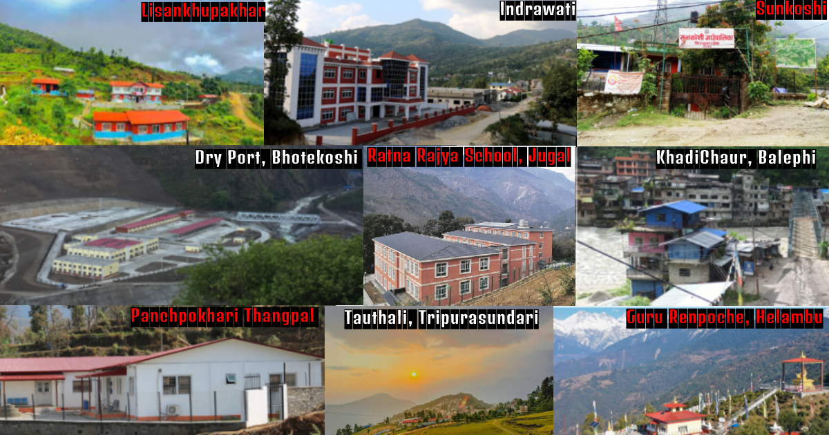
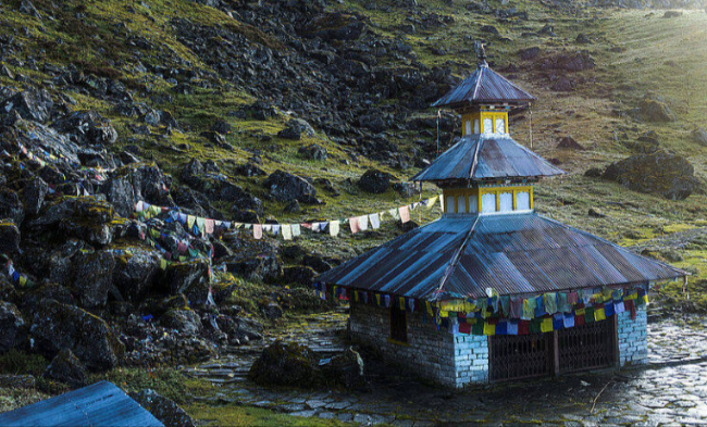
Sindhupalchok district has a total of 9 Rural Municipalities. During the restructuring of the state after the new constitution, the old village development committee was developed as a municipality and a rural municipality. At the same time, Helambu, Jugal, Tripurasundari, Panchpokhari Thangpal, Indrawati, Sunkoshi, Bhotekoshi, Lisankhupakhar and Balefi rural municipalities were formed by combining the wards of various village development committees in Sindhupalchok.
These rural villages are explained below with a brief introduction
Helambu Rural Municipality
Helambu rural municipality comprises former Helambu, Kiul, Mahakal, Palchok and Ichok village development committees. The total area of this rural municipality is 287. 26 square kilometres. The name of this place is Helambu according to the local language because potatoes are produced in large quantities in this area. This rural municipality is a popular destination among national and international tourists, spreading from the middle hills to the Himalayas (1000 meters to 5000 meters). There are only 7 wards in this municipality.
According to 2078, the population of Helambu is 17723 (8816 are women and 8907 are men). There are community health centers in almost every ward of this rural municipality. There are also community schools of good educational quality in the Helambu area. Especially Hyolmo, Sherpa, Brahmin, Chhetri, Tamang and other communities that live in this municipality. The main water supply area of Melamchi is also in this municipality. Most of the people here are involved in commercial agriculture, animal husbandry and tourism business.
Famous Places
- Ama Yangri
- Melamchi Ghyang
- Tarkraghyang
- Shermathang
- Helambu
- Palchok
- Timbu
- Chanaute
Panchpokhari Thangpal Rural Municipality
Panch Pokhari Thangpal rural municipality comprises Thangpaldhap, Thangpalkot, Banskhark, Bhotang, Bhotenamlang, Baruwa, Gunsa and Lagarche village development committees. Its total area is 187.29 square kilometres. Panchpokhari Thangpal rural municipality was named after the famous religious and tourist places Panchpokhari and Thangpal village. There are a total of 8 wards in this municipality. The mountains of the Jugal mountain range, the beautiful natural environment, and local originality have made this rural municipality special.
According to 2078, the total population of Panchpokhari Thangpal is 20978. Within this municipality, child development centers, basic schools, and secondary schools are operating at the community level. There are health posts to provide basic health services from all the wards of Panchpokhari. Tamang, Newar, Chhetri, Sherpa and other communities live in this municipality.
Famous Places
- Panchpokhari
- Raithane
- Ama Yangri
- Tupidanda
- Norsyam Pati
- Mane kharka
Jugal Rural Municipality
- Jugal Rural Municipality was formed by combining Hagam, Selang, Pangtang, Golche, Gumba Village Development Committees.
- Total area 592 square kilometres
- Most of the mountains under the Jugal snow range comedown in this municipality
- Extending up to 7000 meters above sea level
- Dozens of small and large hydropower projects are operating in this municipality
- According to 2078, the total population is 19148 (9657 are males and 9491 are females)
- 22 child development centres, 25 primary schools, 9 basic schools, and 9 secondary schools
- A total of 7 wards
- Almost all the wards have ward health posts
- Inhabited by Tamang, Sherpa, and Newar communities
Famous Places
- Pantang
- Hagam
- Selang
- Gumba
- Digu
Indrawati Rural Municipality
- Consisting of former Simple Kavre, Kunchok, Nawalpur, Bade Village, Sipa Pokhare, Bhot Sipa, Bhimtar Village Development Committees
- Total area 105.11 sq km
- This Rural Municipality is named after the river Indrawati
- Extending from the banks of the Indrawati river to the central hills
- According to 2078, there is a total population of 25518 (12114 are male and 13404 are female)
- Communities such as Tamang, Brahmin, Chhetri, etc.
- Almost all the wards have ward health posts
- Simple Kavre, Golme, Kattike, Thale, Bhirkhark, Dande, Okhreni, Khyang, Aldanda, Kunchok, Kutume, Nawalpur, Salle, Lampte, Koiralatar, Dhuseni, Jamire, Bhote Sipa , Sipa Tar, Neupane, Bhimtar Aselukhark, Bhadaure, Kamaltar, Dumidanda, Tulsidanda, are the market.
- 30 primary schools, 9 basic schools, 12 secondary schools, and 2 campuses,
Famous Places
- Nau Lingeshwar Mahadev
- Raneshwar Mahadev
- Bhimsen Temple
- Grameshwar Mahadev
- Bhimsen Temple
- Sundridevi Temple
- Rani Odar
Sunkoshi Rural Municipality
- formed by merging Thokarpa, Kalika, Sunkhani, Yamuna Danda, Thumpakhar, and Pangretar Village Development Committees
- Total Area 72.84 square kilometers
- Total Population (According to 2078): 15307 (7376 are males and 7931 are females)
- Named after Sunkoshi river
- Total Ward number: 7
- Population density: 210 per square kilometer
- 32 child development centers, 23 primary schools, 4 basic schools, 12 secondary schools and 2 community campuses
- Ward Health Post: Sunkoshi health post, Yamuna Danda health post, Thokarpa basic hospital, Kalika health post, Pangretar health post, Thumpakhar health post
Famous Places
Tirtheshwar Mahadev Place, Tasi Choiling Monastery, Sitapaila, Latteshwar Mahadev, Gaukhureshwar, Basanteshwar Mahadev, Chuni Choiling, Seventh Day Adventist Church, Krishna Temple, Vetravati Temple, Sanling Monastery
Tripurasundari Rural Municipality
- Formed by including former Ghorthali, Dhuskun, Piskar, Tekanpur, Tauthali, Chokti Village Development Committees
- Total area 94.28 square kilometers
- Total ward number: 6
- Named after the famous Tripura Sundari Mai
- Population (According to 2078): 12194 (6222 are women and 5972 are men)
- 19 primary schools, 6 basic schools, and 6 secondary schools
Famous Places
Kali Pokhari, Latteshwar Mahadev, Tripura Sundari Mai, Chumi Potla Gumba, Mangala Mai, Nateshwar Temple, Bhimsen Sthan Temple, Chuli Danda, Ile Bir Bahadur Shaheed Park
Lisankhupakhar Rural Municipality
- Consisting of former Thulo Dhading, Attarpur, Lisankhu, Jethal, Petku and Thokarpa Village Development Committees
- Area: 98.61 square kilometers
- Total ward number: 7
- Total Population (According to 2078): 11560 (5713 are males and 5847 are females)
- 15 primary schools, 4 basic schools, and 10 secondary schools
- Ward health post: Attarpur Health Post, Thulo Dhading Health Post, Lisankhu Health Post, Jethal Post Health Post, Danda Pakhar Post Health Post and Petku Post Health Post
Famous places
Sildhunga, Mude, Lisankhu, Petku
Bhotekoshi Rural Municipality
- Consisting of Tatopani, Listikot, Marming, Phulpingkatti Village Development Committee
- Total area: 278.31 square kilometers
- Total ward number: 5
- Named after the river Bhotekoshi
- Tatopani crossing connecting Nepal - China is located in the rural municipality
- Population (According to 2078): 14239 (6980 are women and 7259 are men)
- Ward health post: Marming Health Post, Listikot Health Post, Phulpingkatti Health Post, and Tatopani Health Post
Famous Places
Dugunagadhi, Miteri Bridge, Tatopani Naka, Tatopani Dhara, Marming, and Listikot
Balephi Rural Municipality
- Consisting of Jalvire, Phalpingkot, Phalping Danda, Mankha Village Development Committee
- Area: 61.87 square kilometers
- Named after the Balefi river
- Total Population (According to 2078): 16465 (8062 are males (48.96%) and 8403 are females)
- Total ward number: 8
- 28 child development centers, 19 primary schools, 5 basic schools, and 10 secondary schools, 1 campus
- Ward health post: Fulpingkot Health Post, Fulping Danda Health Post, and Mankha Health Post
Famous Places
Balefi's Shiva temple, Khadichour market, Karma Dupgyuling monastery (Dhuskun), Balefi river, Jalbire, Mankha, Lamosanghu, Fulpingkot, Fulping Danda, Balefi hydropower
