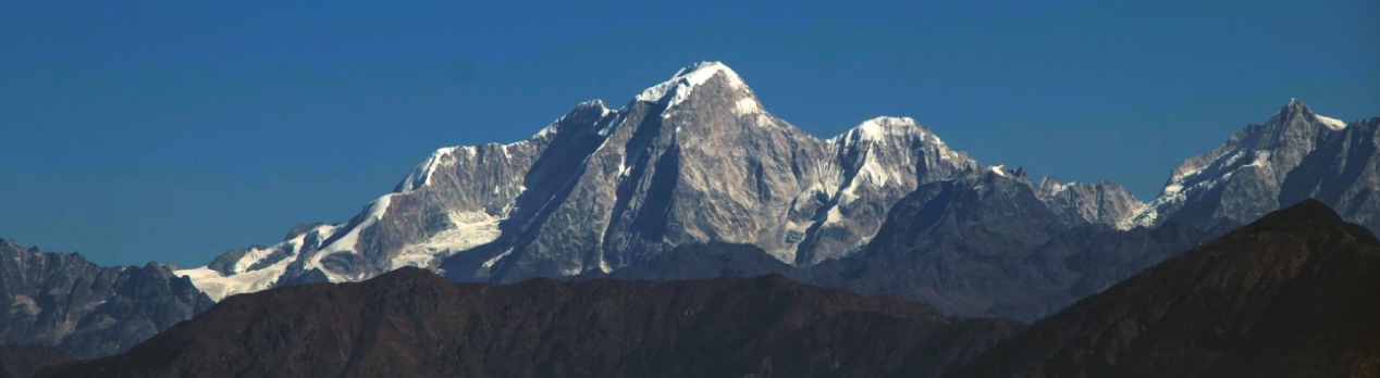
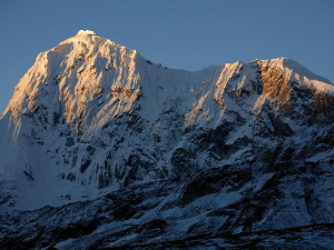
Phurbi Chyachu
Phurbi Chachu Mountain is located in the northeast direction of the capital Kathmandu. This mountain belongs to the Jugal Glacier and Langtang region. Phurbi Chachu is one of the central mountains of Sindhupalchok district. It is located in Jugal Rural Municipality. This mountain is also called Phurbi Gyachu. Recently, this mountain has become the centre of attraction for climbers.
The height of Furbi Chyachu Himal is 6631 meters (21755 ft.). This mountain is spread at 28º 07' 50 latitude and 85º 52' 19 longitude. This mountain was successfully climbed for the first time in 1982. A team including Shintaro Kurokawa, Fumihito Ogawa, Hiromitsu Okamoto, Takashi Shinki, Hajime Takigami, Aung Phuri Lama, and Pemba Lama Sherpa climbed this mountain for the first time. The peak ID of Phurbu Chyachu is PHUR.
Phurbi Chyechu is a mountain that has been chosen by climbers recently. This area is developing as a destination where you can enjoy the natural environment, villages, forests, rivers, fields, culture, etc. for trekking. Phurbi Chechu and the entire Jugal glacier are destinations with immense potential as they are located at a very close distance from Kathmandu and you can enjoy trekking and climbing at a low cost.
Additional Info
Other Name: Phurbi Chhyachu, Purbi Gyachu
Status: Opened
Elevation: 6631 M / 21755 FT
Latitude: 28º 07' 50
Longitude: 85º 52' 19
Route: Jalbire through Araniko Highway and Jalbire-Gumthang-Tembathang-Nyam-Masal Khola-Base Camp
1st ascent by: Shintaro Kurokawa, Fumihito Ogawa, Hiromitsu Okamoto, Takashi Shingaki, Hajime Takigami, Ang Phuri Lama, Pemba Lama Sherpa, Phurbi Chyachu
Health centre/post: Bokse 50.9KM
Nearest settlement: Tharpu 5.2KM
Related Posts