About Sindhupalchowk District, Bagmati, Nepal
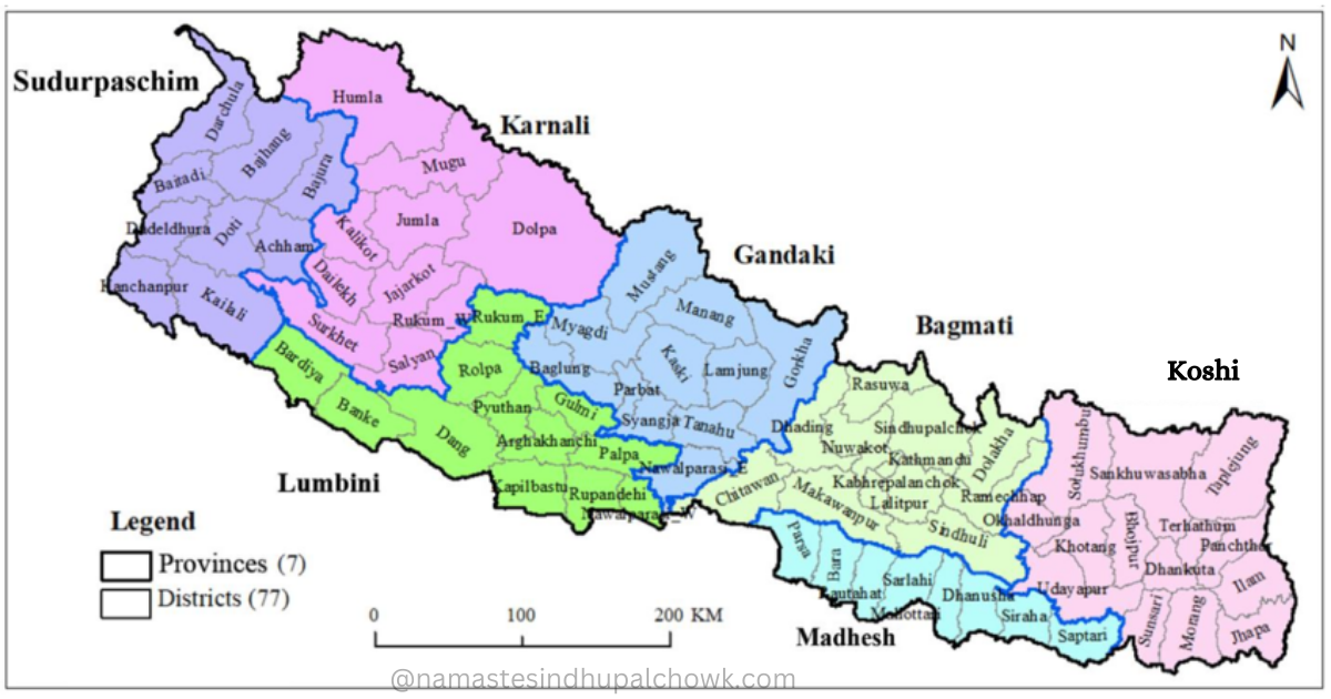
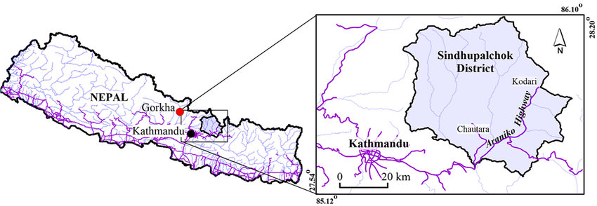
Sindhupalchok district is one of the 77 districts of Nepal, which is spread from the hill to the mountains under the former Madhyamanchal Development Zone and is currently under the Bagmati Province. This district is located share the border with Kathmandu, the capital of Nepal.
The total area of this district is 2542 square kilometers, which is 1.73% of the total area of Nepal. Sindhupalchok is the largest district of Bagmati Province based on size (map), which extends from 27°27' to 28°13' north latitude and 85°27' to 86°06' east longitude on the world map. The east-west average width of the district is 49. 38 km and the north-south average length is 53.06 km. The headquarters of Sindhupalchok district is Chautara Bazar, at an altitude of 1418 meters above sea level.
Langpoghyang is the highest peak in the district which is 23238 feet above sea level. Similarly, the lowest altitude place of the Sindhupalchowk is Majhi village and Banditar, which lies in the former Sangachok Village Development Committee and is currently in Chautara Sangachok Gadhi Municipality. These places are located only at an altitude of 2450 feet above sea level. Sindhupalchok district is geographically rich.
The eastern border of Sindhupalchok district is connected with the Dolakha district and the autonomous region of China, the Nyalayam district of Tibet. Nuwakot and Rasuwa are on the western border of the Sindhupalchok district. Similarly, the northern border is connected with Tibet and Rasuwa districts. The southern border is associated with the Kavre, Ramechhap, and Kathmandu districts.
The district postal code of Sindhupalchok is 45300. There are 13 regional post offices in Sindhupalchowk.
Administrative Divisions
Before 2073 Falgun 27, there were only 2 municipalities and 67 village development committees in the Sindhupalchok district. After the constitution of Nepal in 2072, the administrative form of the country was restructured. According to the notice published in the Gazette by the Government of Nepal on the 27th of Falgun 2073, the previous Village Development Committees and Municipalities of Sindhupalchok District were adjusted to form 3 Municipalities and 9 Rural Municipalities. There are 103 wards in the Sindhupalchok district within the 12 local bodies.
There are 3 Municipalities and 9 Rural Municipalities in Sindhupalchowk District.
Municipality
Rural Municipality
- Jugal Rural Municipality
- Bhotekoshi rural municipality
- Balephi rural municipality
- Lisangkhupakhar Rural Municipality
- Tripura Sundari Rural Municipality
- Sunkoshi rural municipality
- Indrawati rural municipality
- Helambu Rural Municipality
- Panch Pokhari Rural Municipality
Based on the constituencies, there are only 2 areas under the House of Representatives in this district. Which are zone number 1 and zone number 2.
Similarly, there is a total of 4 regions under the provincial assembly. It includes Provincial Assembly Constituency No. 1 (A), Provincial Assembly Constituency No. 1 (B), Provincial Assembly Constituency No. 2 (A), and Provincial Assembly Constituency No. 2 (B).
History of District Naming
According to history, before the administrative division of 2018 (14 zones, 75 districts), Sindhupalchok district was in East No. 1 region, whose main administrative center was Chautara and its small location Dhulikhel. The present Sindhupalchok and Kavre districts were covered under the former No. 1 region. Small “thums” were built here for administrative simplicity. Sindhupalchok district is made up of eight “thums” including two “thums” “Sindhu thum” and “Palchok thum”.
Sindhu, Palchok, Chautara, Nawalpur, Fulpingkot, Tauthali, Listi, and Sipa "thums" (Small Administration Units) are included in the Sindhupalchok district.
Population of Sindhupalchowk
According to the national census of the year 2068, there was a total population of 287798 in the Sindhupalchowk district. The census of the year 2078 has shown that the population has decreased. According to the year 2078, the total population of Sindhupalchok is 262624, of which 129205 (49.2%) are males and 133419 (50.8%) are females.
Population details of Sindhupalchok district as per the year 2078:
- Population density: 103 people per square kilometre
- Population growth: -0.88%
- Average family size: 3.66
- Census House: 69751
- Family Number: 71773
- Sex Ratio: 96.84
- Disability rate: 3.1%
Local Election 2079: Number of Voters
According to the data released by the Election Commission for the local elections of Baisakh 30 of the year 2079, there are 255712 voters in the Sindhupalchok district. In which 132212 men and 123500 women. Similarly, there are 144 polling stations and 316 polling centres.
Educational Institutions and Literacy Percentage
Sindhupalchok district has 19 resource centres, 352 child development centres, 45 non-formal adult schools, 35 institutional schools, 12 graduate campuses, 567 community schools (except 3 open), and 602 total schools (except 3 open).
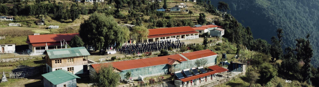
According to the year 2068, the total literacy rate of the district was 59.59 percent, of which 67.97 percent were males and 51.88 percent were females. Similarly, the literacy rate of Sindhupalchowk is 68.04% (75.26% male and 61.13% female) according to national census 2078.
Health institutions
According to District Profile -2075, 1 district hospital, 3 primary health centres, 75 health posts, 49 sub-health posts, 219 village home clinics, 5 Ayurveda dispensaries, 9 community health units, and 4 urban health centres in the Sindhupalchowk.
Looking at the overall health status of the district, new technologies are being used in this area. Patients who cannot be treated in health institutions are referred to Dhulikhel in Kavre or various hospitals in the capital.
Forest
Most of the area of Sindhupalchok district is covered by forests. The forest area covers a total area of 129474 hectares, of which the forest area covered by trees is 57531 hectares, the area covered by shrubs is 32254 hectares and the area covered by grassland is 11823 hectares.
Mainly the forest area is divided into two parts. Community forest and confessional forest. There are 525 community forests and 396 confessional forests. Apart from this, there are also religious forest areas, private forest areas, etc.
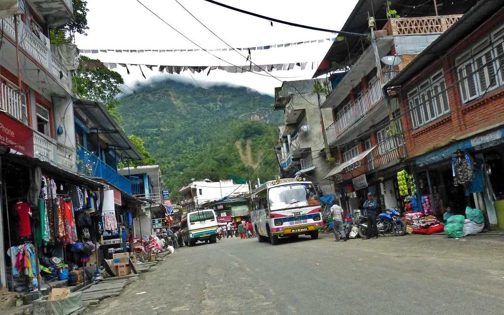
Market (Bazar) and Commercial Center in Sindhupalchowk
The main commercial centres and markets have helped keep various economic activities running. Different grains, food grains, vegetables, domestic products, and essential items imported from outside are gathered in the market areas of the district. Chautara, Tatopani, Melamchi, Khadichour, Bahrbise, Mude, Jalbire, Dolalghat, Talamarang, Nawalpur, Syaule, Sangachok, Lamosanghu, Tipeni, Chanoute, Bahunepati, Sipaghat, Bhotechour, Tauthli, Sukute, Chehere, Timbu, Irkhu, Melchaur, Galthum, Badegaon, Attarpur, Andheri, Batase, Bhimtar, Gumb, Dhuskun, Kunchok, Marming, Jamire, Phatkashil, Sunkhani, Ramchi, Piskar are the small and big markets and business centres of Sindhupalchowk district.
Weather of Sindhupalchok
Sindhupalchok district is spread from hills to high mountains. Of course, there is variety in weather in such a large land. This district covers high areas with heavy snow and areas that do not receive snow at all. During the rainy season, most places in Sindhupalchok district experience heavy rains from midday onwards. As it is a Himalayan district, small and big rivers flow in the lower region. Rivers flood during heavy rains (monsoon), and there is a risk of landslides in areas with weak terrain.
Sindhupalchok district is very cold in the winter (December, January, and February) season. There is heavy snowfall in the upper parts, while the lower parts are also cold due to the mountain air. Sindhupalchok has very favourable weather in spring (March, April, and May) and autumn (September, October, and November).
Rivers and lakes
Melamchi river, Sunkoshi river, Bhotekoshi river, Indrawati river, Balefi river, Bramayani river, Sindhu river, Jhyadi river, Mahadev river, Tauthali river, Wafal river, Gohare river, etc. are the main rivers in the Sindhupalchowk.
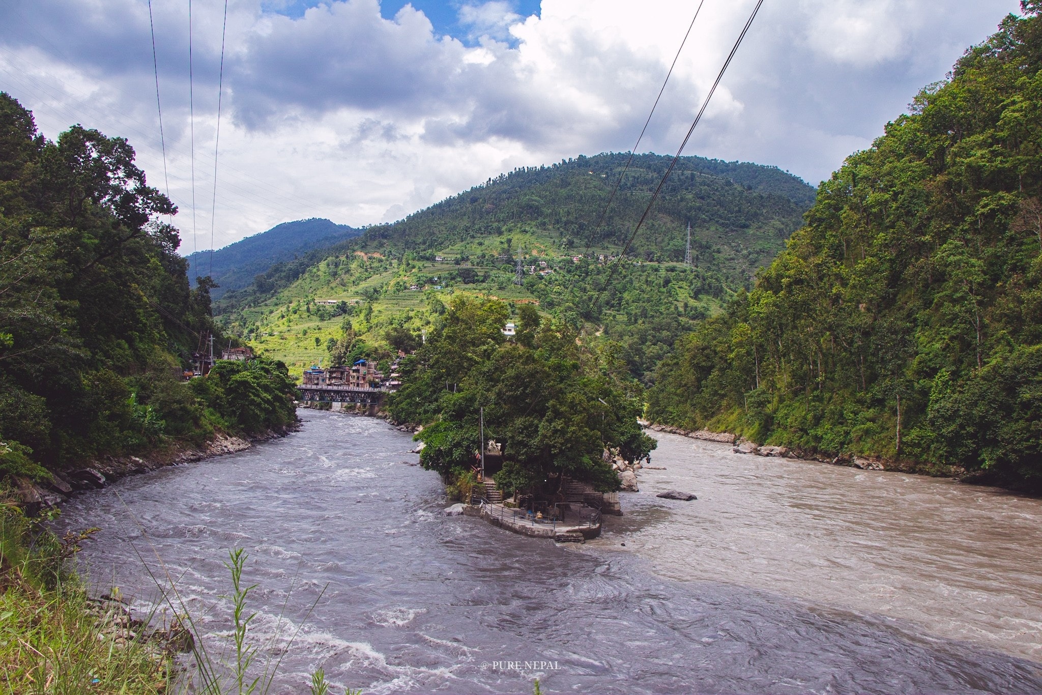
Panch Pokhari, Suryakund, Bhairav Kund, Dhup Kund, Gunya pond, Sipakhola, Gumba lake, are the major lakes of Sindhupalchowk.
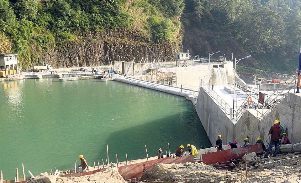
More than a dozen hydropower projects are in operation in the rivers flowing through Sindhupalchok. In terms of hydropower production, Sindhupalchok is the powerhouse.
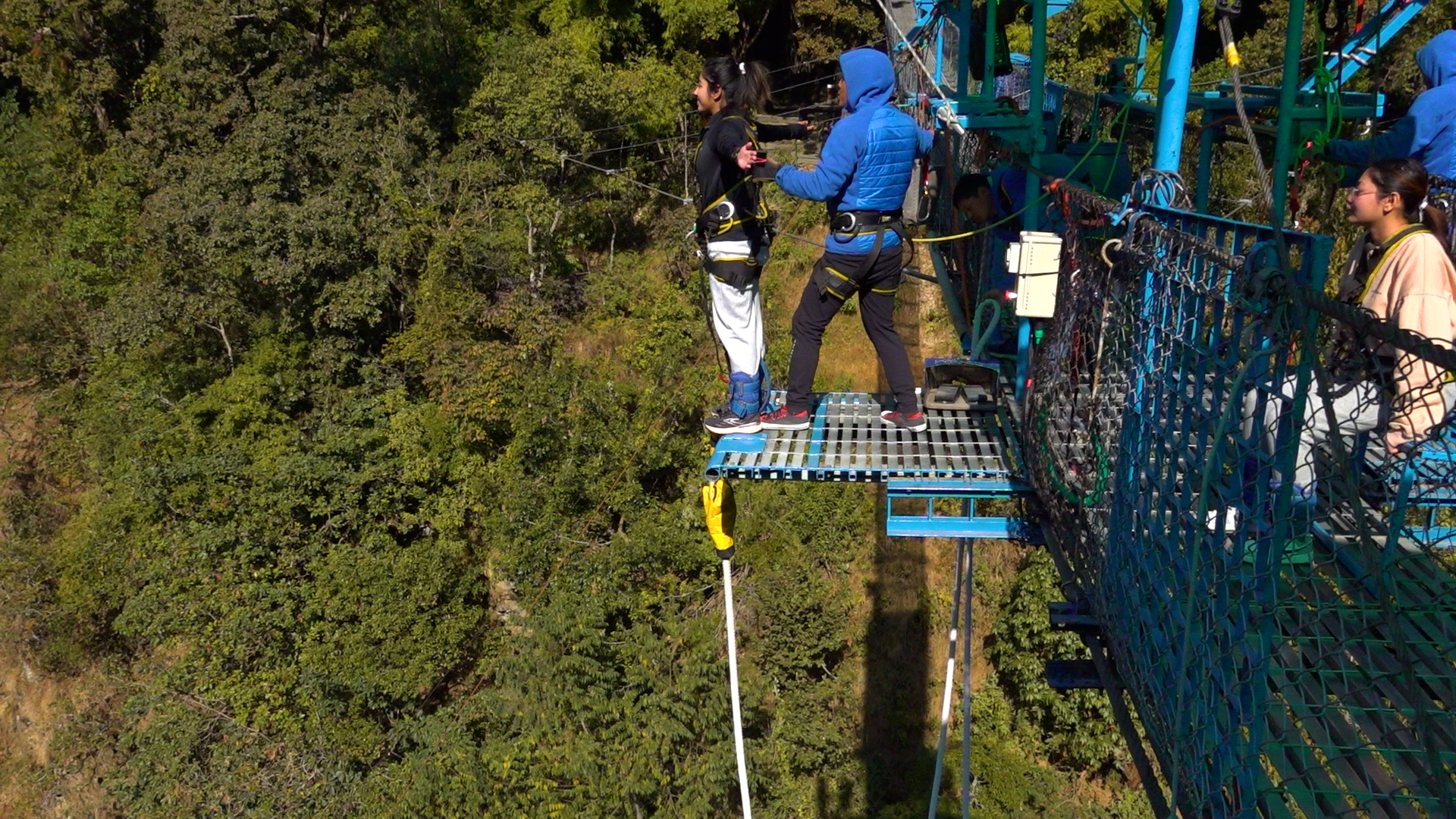
Things to do in Sindhupalchowk (Activities)
- Bungee Jump
- Rafting
- Trekking
- Camping
- Climbing
- Educational Tour, Historical Tour
Historical, religious and tourist places in Sindhupalchok
Sindhupalchok district is very famous for adventure tourism activities like rafting in Bhotekoshi, bungee jumping, paragliding, and climbing. Jugal Mountain, the closest mountain to Kathmandu, the capital of Nepal, is also located in the Sindhupalchok district.
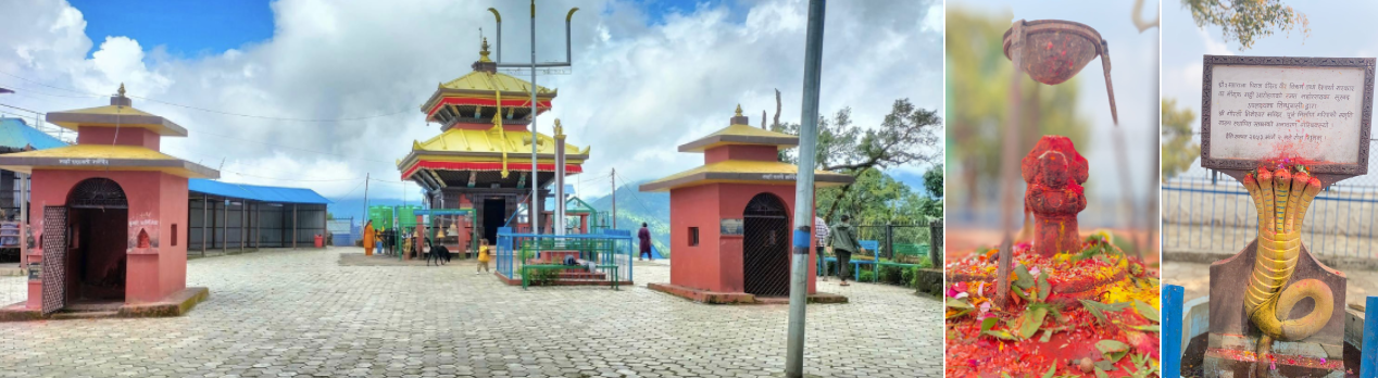
Internationally famous Hyolmo land "Helambu", a group of five angels of heaven "Panchpokhari" are famous tourist spots of Sindhupalchok district. Gaurati Bhimeshwar, Palchoki Mai, Tripurasundari Mai, Naulingeshwar, Balefi Shiva Mandir, Chautara's Krishna Mandir, Harlangbarlang, Kshemadevi, Tatopani, Ama Yangri, Raithane Mahadev, etc. are famous religious places of Sindhupalchowk.
Chautara, Piskar, Dugunagadhi, and Tauthali, are the historical places of the Sindhupalchok district. Patal Gufa, Bhorechaur, Sindhukot, Khadichaur, Bahrabise, and Mude are the other tourist spots in Sindhupalchowk district.
Ethnic groups and Caste
Sindhupalchok district is full of multi-caste diversity. Tamang, Chhetri, Newar, Brahmin-Pahadi, Kami, Sanyayi, Sherpa, Majhi, Damai, Dholi, Magar, Thami, Hyolmo, Sarki, Danuwar, Gurung, Gharti Bhujel, Pahari, Thakuri, Ghale, Bhote, Jirel, Rai, Sonam, Limbu, Sudhi, Muslim, Tharu, Teli, Dhanuk, Kalwar, Rajvanshi, Koili, Kayastha, Kanu, Kushwadi, Mallah, and other castes are living in the different areas of Sindhupalchowk.
Main occupation
Most of the people in Sindhupalchok are involved in agriculture and animal husbandry. People here are involved in business, government jobs, teachers, engineers, politicians, tourism industries, etc. The people of Sindhupalchok are earning good income from commercial agriculture and animal husbandry. Apart from this, people from this region go to the country and abroad for employment.
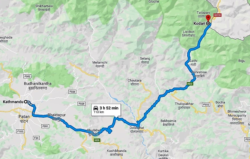
Major highways of the Sindhupalchowk district
Araniko Highway is a major road section in Sindhupalchok District. This highway has been playing a major political role in the development of the Indus. Goods entering Nepal through the Tatopani pass reach the capital through this highway. Apart from this, various parts of the district have been connected to the headquarters and the capital by auxiliary roads including Dolalghat-Bandeu-Chautara, Jirokilo-Malemchi-Helambu, and Khadichour-Mude roads.
Security agencies
Organizations such as District Administration Office, Nepali Army district headquarter (1) and various camp, Police Service (21), District Traffic Office, Armed Police Service (4), District Coordinating Committee and local bodies are active in Sindhupalchowk to ensure security to citizens across the districts.
Sindhupalchowk Earthquake 2015
Sindhupalchok is one of the 14 districts of Nepal that were heavily affected by the 2072 BS (2015 AD) earthquake. For some time after the earthquake, the people here were completely deprived of communication, electricity and mobile network. Most of the houses from the town of Sindhupalchok to the village were completely destroyed.
Sindhupalchowk Election Result: Parliament & Provincial Election Result 2079
The following candidates won from Sindhupalchok district in the representative and Provincial assembly member elections held on November 4, 2079. (including nearest competitor)
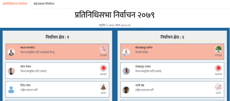
Parliament Constituency No. 1
- Won: Madhav Sapkota "Subhodh" from CPN Maoist Center
- Nearest Competitor: Saresh Nepal from CPN UML
Provincial Constituency No. 1(1)
- Won: Masina Khadka from Nepali Congress
- Nearest Competitor: Yudh Bikram Tamang from CPN UML
Provincial Constituency No. 1(2)
- Won: Saral Sahayatri from CPN Maoist Center
- Nearest Competitor: Hom Narayan Shrestha from CPN UML
Parliament Constituency No.2
- Won: Mohan Bahadur Basnet from Nepali Congress
- Nearest Competitor: Sher Bahadur Tamang
Provincial Constituency No. 2(1)
- Won: Yubraj Dulal from CPN Maoist Center
- Nearest Competitor: Aman Singh Tamang from CPN UML
Provincial Constituency No. 2 (2)
- Won: Krishna Kumar Tamang from Nepali Congress
- Nearest Competitor: Hasta Bahadur Pandit from CPN UML
Hydropower Project in Sindhupalchok
Sindhupalchok is a district spread in the Himalayas. Many rivers flow here. Many hydropower projects are being operated in small and big rivers. Looking at the estimated data up to January 2023, there are around two dozen hydropower projects in the Sindhupalchok district, big and small. Sindhupalchok is one of the largest hydro stations in Nepal.